Design and Engineering
Gold Line Updated Design Plans
The METRO Gold Line BRT project refined route and station site designs to 100% completion.
You can learn more and get your questions answered in the following ways:
100% design plans of the full route
Bridge and wall illustrations
Contact Liz Jones via email or phone with questions:
elizabeth.jones@metrotransit.org or 651-602-1977
Project Development and Engineering
During the design and engineering of the METRO Gold Line project, staff will further analyze the cost and relationships between design concepts proposed in the Pre-Project Development phase. At the conclusion of design and engineering work, the project will have the specifications and blueprints that will guide the construction.
Design concepts that are further studied and specified during design and engineering, include:
- Vehicle and vehicle technology
- Route and alignment
- Station locations and amenities
- Park & Ride lots and layover or maintenance facilities
- Landscaping
- Drainage
- Utilities
- Bridges and tunnels
- Transit service plans
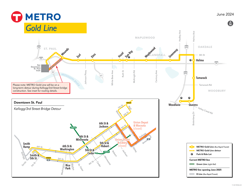
The Gold Line will travel approximately 10 miles in primarily bus-only lanes through downtown Saint Paul, Saint Paul east side, Maplewood, Landfall, Oakdale and Woodbury and stop at 16 stations and four new Park & Ride facilities. The lanes dedicated only to transit buses will be built north of Interstate 94.

Questions and comments by station can be submitted directly through the website at the below links.
Contact Liz Jones via email or phone with questions:
elizabeth.jones@metrotransit.org or 651-602-1977
Station locations:
Downtown Saint Paul
Saint Paul
Maplewood
Oakdale and Landfall
Woodbury
Note: Layouts are a work in progress and subject to change.
Station area planning
Washington County conducted station area planning around proposed Gold Line stations within the corridor. This work allowed coordination of planning, land uses, and policy development along the line. Planning around the Gold Line has and will continue to allow cities and project partners to identify new opportunities for economic development, ridership growth, and creation of Transit-Oriented Development (TOD) sites near station areas. Washington County's station area planning work was completed in 2019.